
Korea Cross-Country Cycling Trip 00 (2) - Brief Introduction
- Jinwook Chang
- Aug 8, 2025
- 5 min read

This is Part 2 of my Korea Cross-Country Cycling Trip series—while Part 1 covered frequently asked questions, this post dives into the general logistics of the trip, including route planning and preparation tips.
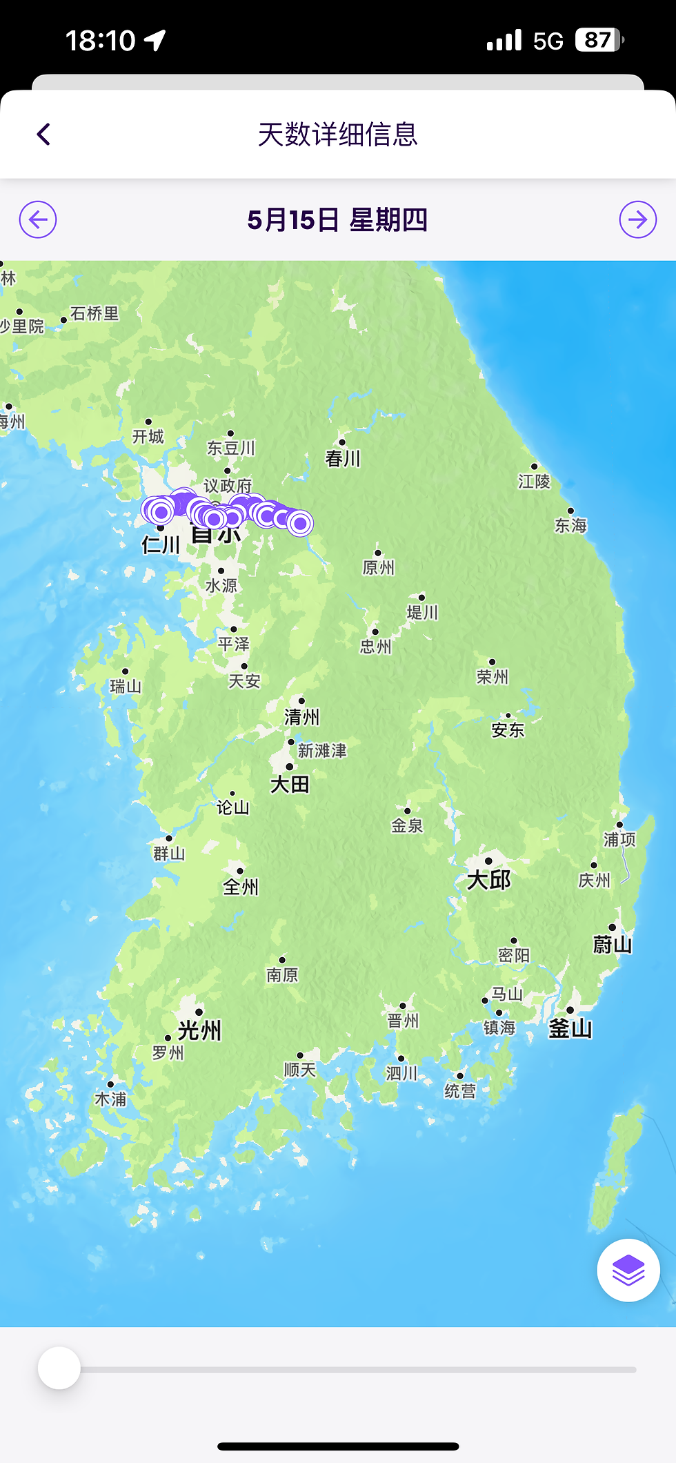
In this blog, I will be covering the different stations you must pass to receive the completion certificate of the Korea Cross-Country Cycling Trip, administered by the Korean Ministry of Environment and the Ministry of the Interior and Safety.

Here you need to take the paths 02 Ara Bike Path (21 km), 10 Hangang Bike Path (150 km), 11 Saejae Bike Path (100 km), and 12 Nakdonggang Bike Path (330+ km), totaling 633 km in total. Cyclists most commonly attempt this challenge in either four-nights-five-days or five-nights-six-days.
Now let me give you detailed introduction into each path.
[02] Ara Bike Path (21 km)
The Ara Bike Path follows the Gyeongin Ara Waterway and marks the official starting point of Korea’s cross-country cycling route. Spanning about 20 km, it’s a completely flat and beginner-friendly trail connecting Incheon to the Han River. Though not the most exciting segment, it’s a great warm-up for longer routes like Saejae or Nakdonggang.
There are two main entry points: the north (Gimpo Hangang Lock) and the south (Gimpo Ara Lock). The southern route is simpler and less crowded, while the northern entrance involves a confusing U-turn and bridge crossing near Jeongseojin, often packed on weekends due to nearby outlets.
The path includes parks, convenience stores, and rental stations, but there are no public water fountains, so bring or buy water. In shared park zones, the trail becomes tiled and pedestrians are common—slow down and stay alert, especially on weekends.
Wind conditions can greatly affect your ride. Strong sea breeze blows inland during the day, making westward travel difficult. At night, streetlights are off for energy conservation, so bike lights are essential. Also, watch out for crabs (참게) crossing the trail on summer nights—they’re slippery and can cause accidents.
Near the southern end, large logistics trucks are common—stay on the bike lane and avoid the roads. Some older convenience stores have closed, but there’s a food truck near Hangang Lock and a new seafood complex near Geomam Station.
Once the Cheongna Sky Bridge opens in late 2025, reaching Incheon Airport via this route will be much easier using well-paved bike roads. Until then, alternate routes exist but often involve busy roads and airplane noise.
Overall, Ara is a calm, easy ride with solid infrastructure, ideal for first-timers—just plan for wind, night visibility, and water.
[10] Hangang Bike Path (150 km)
The Hangang Bike Path in Seoul predates the national Four Rivers cycling project and was first built around 1993, later formalized in the late 1990s. It remains one of the best-equipped cycling routes in Korea, with frequent convenience stores, repair stations, rest areas, and bike rental options. Even if you don’t own a bike, you can easily rent one from local vendors or use the Seoul public bike system “Ddareungi”, available at various stations. Ddareungi costs just ₩1,000 for 24 hours, though each ride is limited to one hour unless you re-dock and borrow again.
The path is popular and crowded, especially near parks like Yeouido. Due to the number of pedestrians and occasional reckless cyclists, riding cautiously is essential. The recommended speed limit is 20 km/h, and while this is not strictly enforced, it's a good rule to follow in a shared-use space like this. Remember, the path runs through Hangang Park, which exists for public leisure—not exclusively for cyclists.
One of the great advantages of the Hangang route is its connectivity. It links to tributaries like Anyangcheon, Tancheon, Banpocheon, and more—allowing short or long scenic rides throughout Seoul and beyond. You can also loop around Yeouido using the connected Saetgang Bike Path, though keep in mind only the southern side has a designated bike lane.
For those heading east toward Namyangju or Hanam, there are two notoriously steep hills to watch for: Amsa Hill (south side, nicknamed "IU Hill") and Mieumnaru Hill (north side, known as “Ggaldak Hill”), both of which involve long, steep climbs. If you're planning a longer ride, pace yourself here.
If you're collecting stamps for the national cross-country certification, you only need to get stamped at either the Ttukseom Certification Center (north side) or Gwangnaru Bike Park (south side). But many riders get both. The ideal scenic route includes crossing via Jamsu Bridge, heading to Ttukseom, then looping through Jamsil Railway Bridge, Gwangnaru, and further east to Paldang Bridge and Neungnae Station. Some sections, like around Paldang, can be confusing, so check your map in advance.
In short, the Hangang Bike Path is arguably Korea’s most accessible and comfortable route, especially for city riders. It combines beautiful riverside views, abundant facilities, and seamless connectivity—perfect for both leisure riders and long-distance cyclists starting their cross-country journey.
[11] Saejae Bike Path (100 km)
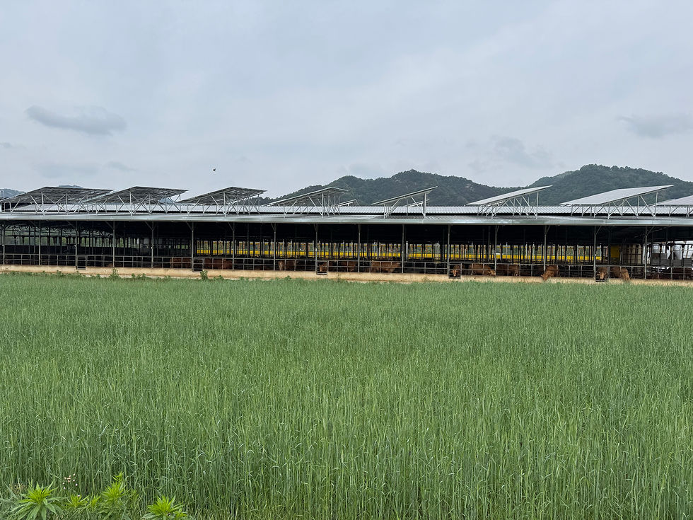
Except for the segment entering Mungyeong (Jomchon) from Sangju, most of this stretch is a shared pedestrian-bike path that follows narrow, lightly paved farm roads along the Dalcheon, a tributary of the Namhan River. The route frequently passes through small farming villages, so it’s important to ride respectfully—no littering or speeding, especially with local farmers often working nearby. Signage can be easy to miss, so you need to stay alert to avoid wrong turns into private or unrelated roads.
Much of the trail overlaps with local provincial roads, and many cyclists actually prefer the main road over the official bike path, which is often patchy and rough with uneven cement. The ride through this area is far more scenic and peaceful than earlier sections, with unexpected highlights like Palbong Waterfall and beautiful countryside views. Car traffic is minimal, making it a comfortable and relaxing ride, perfect for enjoying Korea’s rural charm.
[12] Nakdongang Bike Path (330+ km)
The Nakdonggang Bike Path is often called the “Nakdong Desert”—and it’s no exaggeration. This section is long, remote, and seriously lacking in rest stops, shade, and convenience stores, unlike the well-equipped Han River trail. When you see any place to resupply, do it immediately. Riders starting the cross-country trip from Busan (northbound) are usually still fresh and mentally focused, making the desolate landscape more manageable. But for those riding southbound from Incheon, the Nakdonggang section hits after the relatively cool and lively Han River and Saejae routes—making it feel mentally and physically draining despite minimal elevation gain.
Many riders skip Andong Dam, entering the Nakdonggang trail from Sangpunggyo Bridge in Sangju, or heading directly to the Saejae route, which still qualifies for national certification. However, if you want to earn the Nakdonggang-specific certification, you must start at Andong Dam. Be warned—the dam is far from Andong Station and Terminal, and simply reaching the trailhead is a challenge in itself.
Even if you skip the upper part and start at Sangpunggyo, the distance to Busan is still around 324 km, with very few places to sleep or buy supplies. The stretch from Daegu to Busan is especially difficult due to poor road conditions. For many cyclists, this section becomes the ultimate endurance test of the entire cross-country journey.
In the next blog, I will introduce you to the detailed stations you must visit in these bike paths. Stay tuned for the next update.

Comments